Product Description
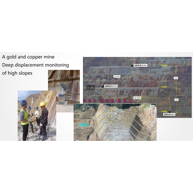
Slope monitoring system solution
The multi-dimensional micro-magnetic high-precision sensors independently developed by our company can realize fully automatic real-time monitoring of displacement changes inside the slope, which fundamentally solves the existing pain points. The system consists of three major parts: an array-type high-precision micro-magnetic flexible inclinometer composed of high-precision sensors, a data acquisition unit and a transmission unit, and a data analysis platform. It has obtained a number of inventions, new patents and soft writings, and has completely independent intellectual property rights.
1、Monitoring platform
Slope stability monitoring system is self-developed, obtained software copyright
True three-dimensional real-time display of the spatial attitude of the monitoring hole, the
Display content: displacement, angle, direction, temperature, water level, etc.
Rich interface: can connect other sensors and synchronize the display, such as, rain, GNSS, video, etc.Innovative encapsulation process: factory integrated production, lightweight design (<500~1000g/m), water pressure resistance >2Mpa, tensile strength >700KGF.
Ultra-large measurement length: CAN bus communication mode, distributed collection and storage of measurement data, centralized sending mode, overcoming the disadvantages of traditional communication methods of data packet loss, the maximum can be achieved 220 sections (sections / m) array measurement length.
Ultra-high precision guarantee: innovative algorithms and encapsulation process, to overcome the traditional encapsulation process brought about by the system torsion error, can provide more stable measurement accuracy.
Ultra-large deformation range: Innovative encapsulation process and installation process can ensure that the device and the object to be measured in a wide range of synergistic deformation, and can achieve >1000mm large deformation range measurement.
Automatic real-time telemetry: data collection at regular intervals, remote control of collection intervals, wireless transmission by DTU module.
Cloud Intelligent Management: Cloud data management system, cloud intelligent solution for deep displacement.
True three-dimensional spatial attitude: real-time true three-dimensional dynamic display of monitoring hole spatial attitude.
Multiple measurement modes: different layout and installation modes have different monitoring functions, which can meet the monitoring of foundation pit, slope, settlement, convergence, etc.
High comprehensive cost-effective: eliminating laborious on-site measurement, simple installation, easy operation without special training.
2. Principle
Innovation point:
Landslide monitoring system real-time monitoring of displacement, inclination and direction of the monitoring point by using earth micro-magnetic passive sensing technology.
Monitoring principle:
Slope monitoring equipment is based on high sensitivity micro-magnetic sensors to monitor the weak geomagnetic changes in the X,Y,Z axes at different locations, and then analyze the spatial attitude of the equipment by integrating the Gaussian geomagnetic field model, space vector calculation, etc., so as to accurately measure the changes in the displacement, inclination, and direction.
3、Sensors
A single sensor to the earth’s intrinsic vector field to the north as a reference can be synchronized to measure the displacement, inclination and direction of the displacement direction of the building, geotechnical body has more value for the application of the direction of the displacement of the building, the application of a wider range of applications, such as earth and rock dams, high slopes, flexible structures, floating platforms and other foundations on the water.
parameter
| Parameter | Indicator |
| Displacement accuracy | <±2mm/100m |
| Angular sensitivity | 0.001° |
| Orientation accuracy | ±0.5° NE |
| 3D measuring range | 360° (spherical space) |
| Maximum allowable length | 220m (single section 1m) can be customized |
| Water Pressure Resistance | ≥2MPa |
| Working Temperature | -40℃~+70℃ |
| Temperature monitoring | ±0.5°C |
| Water level (optional) | 0.01m |
| Parameter | <0.03w/only |
| Displacement accuracy | 12V DC / 220V AC / Solar |
| Angular sensitivity | Φ30×1000 (support customization) |
| Orientation accuracy | Approx. 1.1kg/only |
For product specifications, please download the product specification book to read.


